- Tags:
- Land Conservation,
- Clean Water,
- Climate
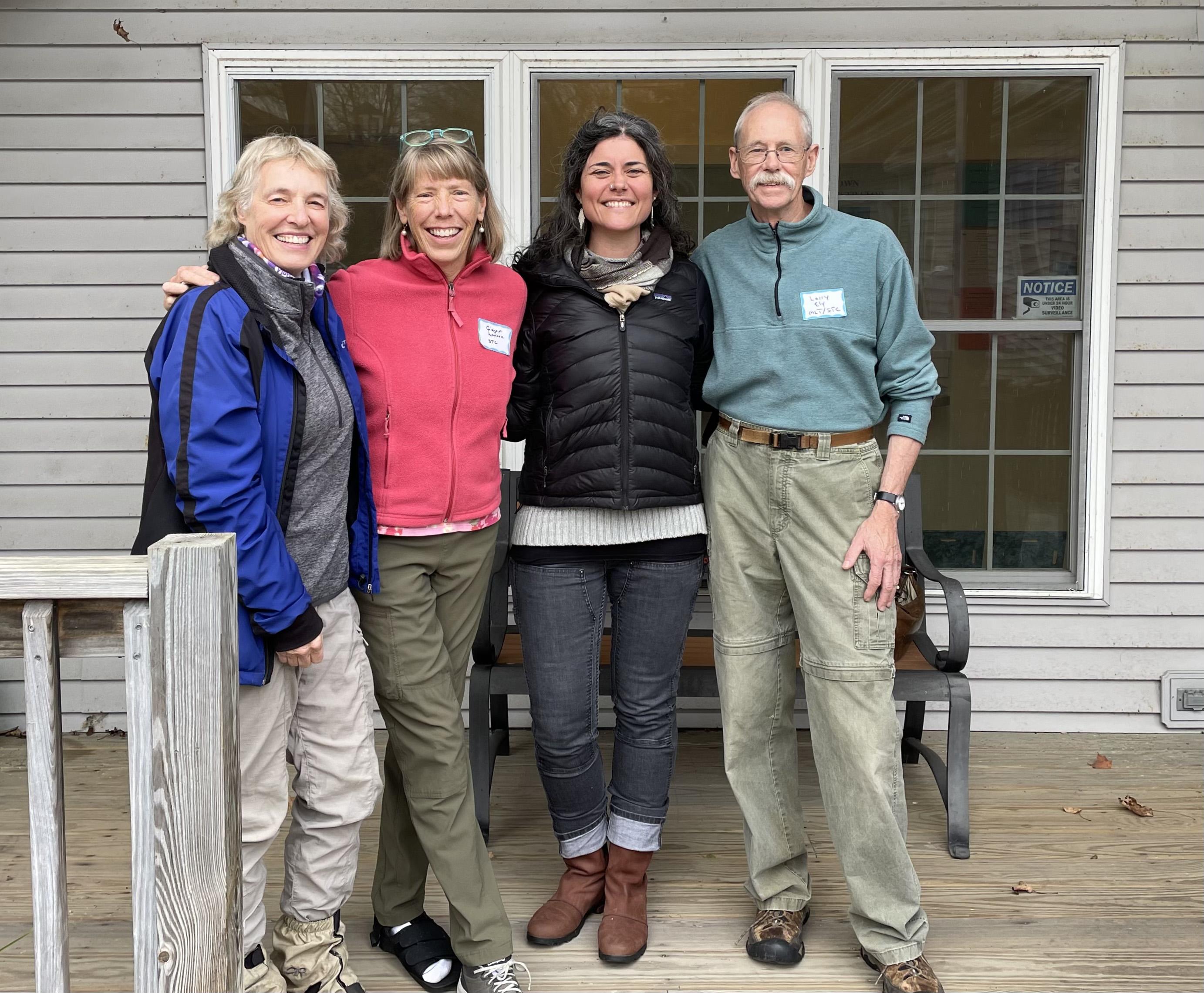
Starting in 2005, Ginger Lawson and Larry Ely drew together a partnership with multiple landowners, Mahoosuc Land Trust, and The Conservation Fund to protect their family lands. Pictured from left: Shelburne residents Katie Stuart, Ginger Lawson, Sally Manikian, and Larry Ely.
From the autumn 2023 issue of Forest Notes magazine
Want to read more articles from Forest Notes? Join as a member to receive a print copy in your mailbox!
By Sally Manikian
Fifteen years ago, I crawled out to the middle of a ledge on the slopes of Cascade Mountain to reach a stubborn, skinny tree with a yellow blaze on it that needed more paint. One foot on public land, one foot on private land, I stood on the boundary line of the Appalachian Trail. With the Lead Mine Brook valley spilling out below me, I visualized the map and topography, the narrow, vulnerable band of the Appalachian Trail surrounded by the unknown. I wish I could tell that version of myself how much was possible, the part I would play and the power I would have. I wish I could tell her, as she stood muddy and dirty and utterly alone, that she was exactly where she needed to be—feet on the ground of the land in need.
Since the early 2000s, through no single person or organization, a mosaic of conservation projects have helped to protect lands formerly owned by the Brown Paper Company in the Mahoosuc Range and Androscoggin River Valley. What was once a big white space on a map has slowly turned green, nearly 75,000 acres through the effort of different conservation ownerships from federal and state agencies to community forests. These conserved lands are one of the best examples of persistence, effective partnerships, and good teamwork.
Years before I encountered those steep Mahoosuc ledges, my predecessor at The Conservation Fund (TCF), Nancy Bell, had her first encounters with Larry Ely, her “conservation stalker.” A part-time resident of Shelburne, N.H., Larry analyzed the land ownerships across the vast forests of the town and persistently approached Nancy at every meeting or conference to say, “You have to come see Shelburne; you have to come see what is worth protecting.” In 2005, Larry and his wife Ginger Lawson invited Nancy to their front porch to see their prized view.
What Larry and Ginger saw in the slopes of the Mahoosucs was an extraordinary conservation opportunity for small local family landowners and large industrial timberland ownerships. Since Shelburne’s founding in 1769, the landscape had largely remained unchanged, but increasing pressures from changing landowners and interests in development posed a real threat.
Nancy was convinced, and through TCF she launched a decades-long partnership that continues today. The foundation of this partnership was built on Larry and Ginger’s local skill and understanding of landowners, TCF’s expertise in landowner negotiations and leveraging conservation funding, and Mahoosuc Land Trust (MLT) as a local conservation group. Leveraging a donated conservation easement on their own lands on First Mountain Forest, by 2013, three easements totaling 1,000 acres closed in Shelburne resulting in the first conservation lands to be established in the town in more than 15 years.
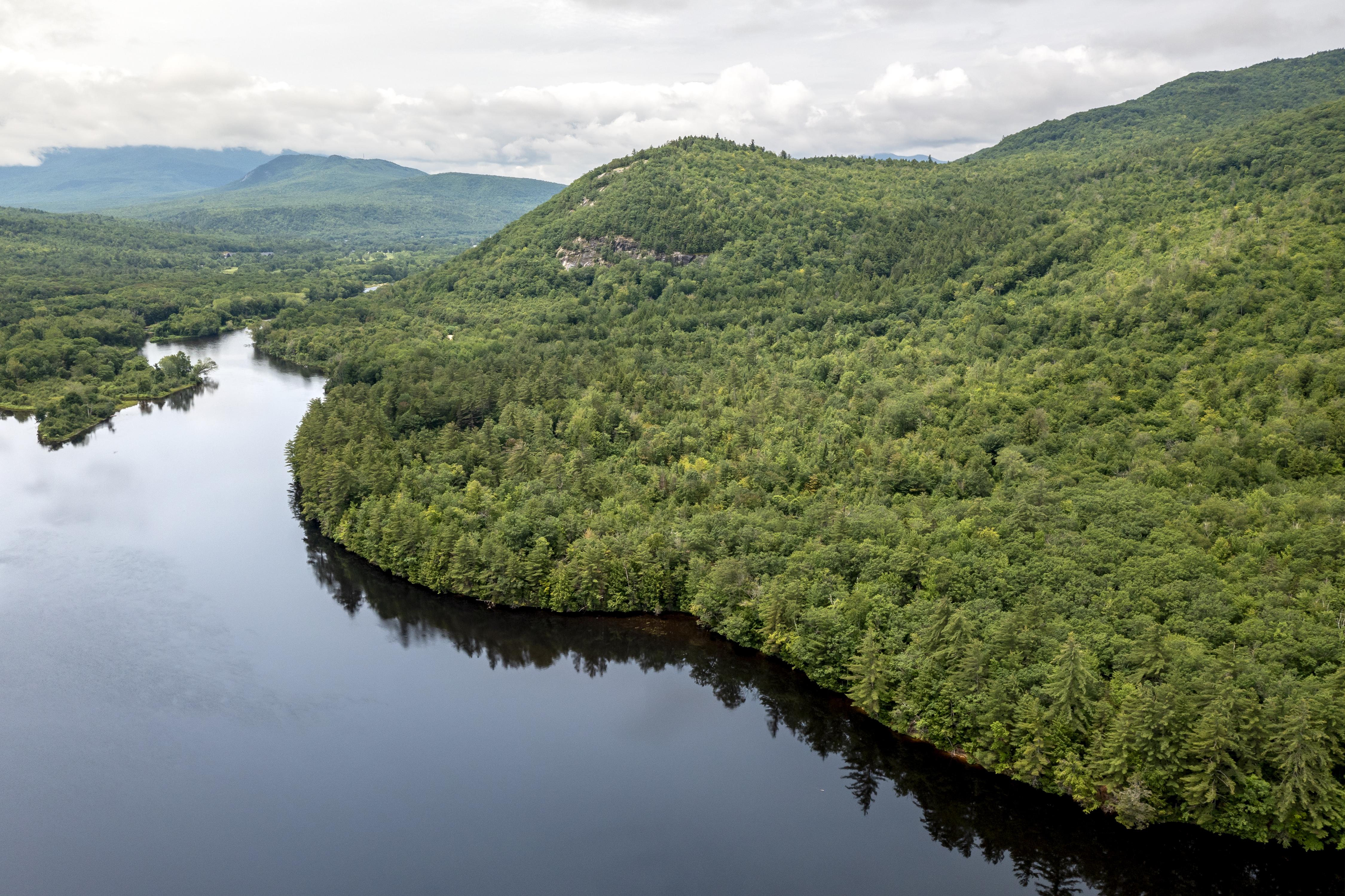
Simultaneous to these conservation efforts, in 2008 TCF purchased Bald Cap Peak Forest, 1,300 acres bordering Dream Lake, Page Pond, and containing Giant Falls and Middle Mountain. Pursued thanks to a lead from Larry, the acquisition intended to widen the Appalachian Trail’s corridor, ultimately rendering boundary lines I had once maintained unnecessary. Not long after, I walked Bald Cap with Larry, and he spoke about the possibility of new trails created by the nascent Shelburne Trails Club. I also met with the then-members of the Conservation Commission, interviewing them for the local paper about their desire to cultivate a conservation vision, faced with a recognition that what Shelburne had long loved and enjoyed was not forever guaranteed to stay the same.
Following these early conservation successes, the next phase within Shelburne resulted in a strong and cohesive community understanding and vision of what conservation could and should look like. As the Shelburne Trails Club reclaimed old treadway, developed new routes, and gained volunteers, they also cultivated appreciation for protecting trails and recreational opportunities as residents held tools in their hands and put their feet on the ground.
Later in 2009, the Shelburne Conservation Commission held an open house to hear residents’ concerns about the natural resources. Outside of a normal Master Plan process, meeting participants showed strong support for conservation in the face of the most imminent concerns and threats: community support for shoreland protections matching concern about development along the Androscoggin River, conservation of working lands matching concerns about the future of industrial timberland ownership, and support for a town forest as a solution. These same themes appeared again in the 2016 Master Plan, and two years later a 2018 Public Attitudes Survey by the Shelburne Conservation Commission set the stage for the next phase of large-scale land conservation: exploration of creating a town forest, protection of access to trails, protection of scenic beauty, and maintaining access to the Androscoggin River. In 2019, the Shelburne Selectboard approved the formation of a Shelburne Community Forest Committee to explore conservation and possible formation of a town forest.
At the same time, I had transitioned to my current role at TCF, and actively pursued conservation of the lands I stood on near Cascade Mountain 15 years before. Bayroot LLC, a private timber company, was ready to release a mix of lands in Shelburne for sale for conservation, an 880-acre array of 22 parcels of islands and shorelands on the Androscoggin River, and 2,700 acres of upland forest hugging the highest elevations of the Mahoosucs. The islands would be first, giving me time to figure out the solution for the uplands—it was time to talk to Larry, Ginger, and Katie Stuart.
Katie Stuart had long been behind the scenes in the many aforementioned conservation efforts, and by 2019 she had assumed the role of Chair of the Shelburne Conservation Commission. When faced with this enormous opportunity to realize the vision long developed, Katie and the commission thought long and hard about the “how.” Shelburne is a small town, barely 350 residents, with a modest operating budget. Was there a way to achieve some of the most important benefits of a community forest, without the town absorbing the responsibility of owning that much land?
The conservation of the 880-acre Shelburne Riverlands in 2021 served as a pilot for how that might be possible. MLT stepped forward expressing interest in owning the Riverlands, the islands, intervales, and wetlands spread across the valley of Shelburne, representing the most wild and scenic portion of the Androscoggin River in New Hampshire. With the support of the Shelburne Selectboard and the Conservation Commission, MLT acquired the properties after fundraising more than $1.2 million in less than one year, resulting in the conservation of the vast majority of Shelburne’s river frontage, long a conservation priority for the town. MLT created a local stewardship subcommittee comprising Shelburne residents and landowners to guide the management and use of the Riverlands, ensuring that local voices were involved in management decisions, an important component of a community forest. The subcommittee developed a 10-year plan that reflected the wishes of Shelburne residents, and management will continue to be guided by the subcommittee. The success of this model, pairing high-capacity stewardship of a land trust with genuine engagement with local communities, led to the next big thing: the Mahoosuc Highlands.
Rising from the Androscoggin River to the ridgeline of the Mahoosucs, an enormous sweeping swath of Shelburne’s mountains could be protected by combining the 2,700 acres from Bayroot with the 1,030 acres from TCF’s Bald Cap parcel. In my role at TCF, I had long been talking with Forest Society Vice President for Land Conservation Brian Hotz about the Forest Society’s land conservation priorities in the North Country, and these lands together perfectly fit the Forest Society’s goals. Like the meetings with conservation groups almost 20 years before, Brian came to Larry and Ginger’s front porch to meet with residents and learn about what Shelburne needed from the Forest Society, and what they could do for Shelburne. This project would be a major expansion of the Forest Society’s presence beyond its 82-acre Peabody Forest in Shelburne, which the two properties would surround. With the full support of the Selectboard, the Forest Society, with assistance from TCF, moved forward in the acquisition of the Mahoosuc Highlands.
“These 3,700 acres are the result of years of local leadership and volunteerism, into which the Forest Society is thrilled to be a new and important partner,” Brian said. “This is a working forest that the community wanted to keep in the timber base but under conservation management. Significant recreational resources and water and forest resources coincided with our ramping up our North Country staffing at The Rocks in Bethlehem while working with an enthusiastic and committed community to build on two decades of collaborative conservation.”
In September 2023, the 2,700 acres known as the Shelburne Valley Forest and the 1,030 acres known as the Bald Cap Peak Forest—together the Mahoosuc Highlands—were purchased by the Forest Society and protected forever. Many local, state, national organizations, and funding programs came together to provide the funds and support needed to facilitate the conservation project, including the federal Community Forest Program, the state’s Land and Community Heritage Program and the NH Department of Transportation mitigation program, in addition to grants from the Appalachian Trail Conservancy’s Wild East Action Fund, the Randolph Area Conservation Opportunity Fund of the New Hampshire Charitable Foundation, and gifts and grants from 160 individuals and organizations.
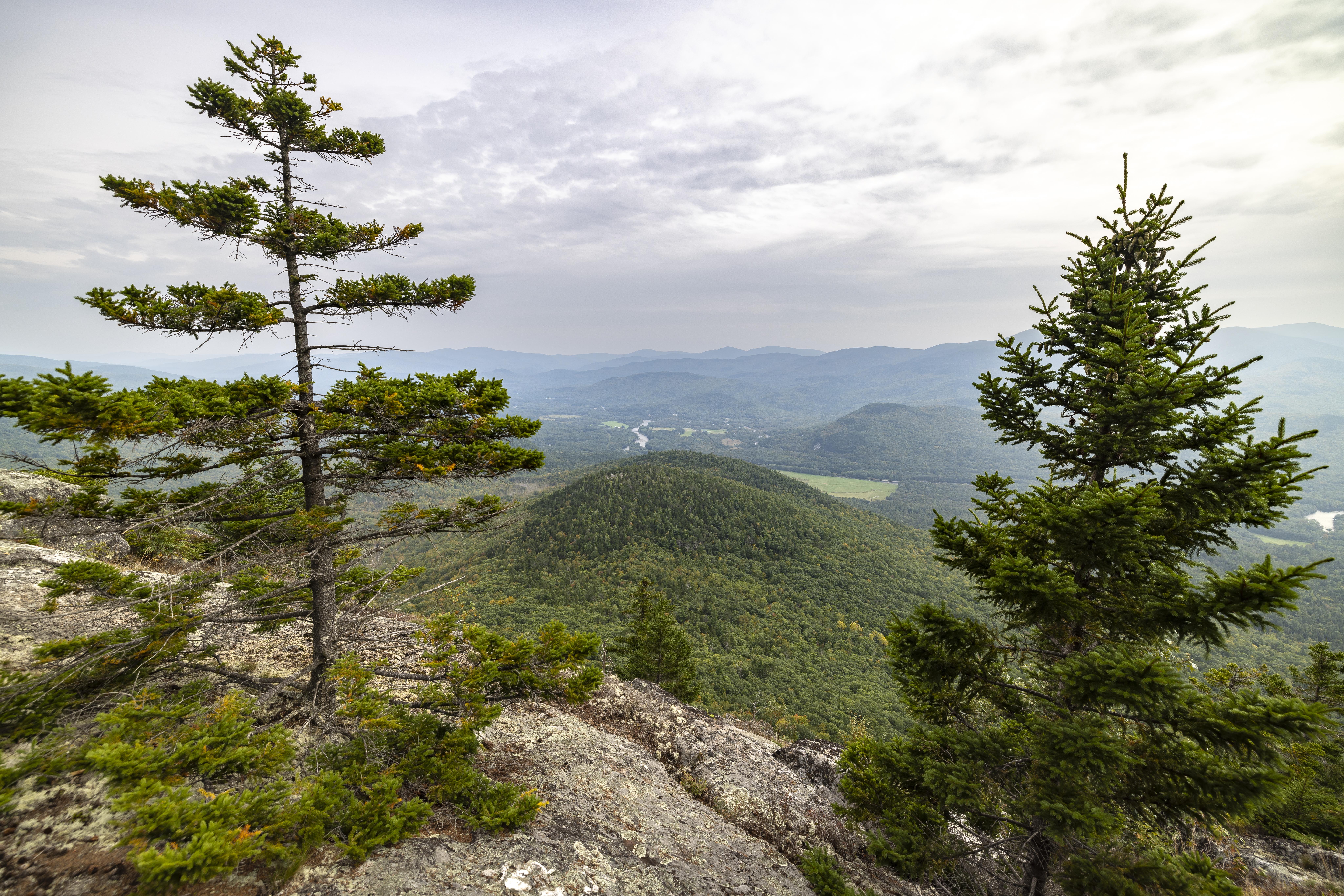
I am so grateful to the Forest Society for holding the ledges, valleys, and mountains of the wild Mahoosucs in permanent stewardship. When I drove past the hulking ridge of Bald Cap for the first time after the project closed, I was struck with relief, love, joy, and excitement knowing that this enormous community-wide effort had paid off. There are other unprotected mountains and valleys in the Mahoosucs, though. There is more to do—and there are so many good people poised to make that happen. Let’s keep going.
Sally Manikian is the New Hampshire and Vermont representative for The Conservation Fund.
Thanks to Larry Ely and Katie Stuart for contributing to this article.
