


About the Property
The parking lot at Mt. Major is OPEN and the sustainability upgrade to a section of the Main Trail is complete! Learn more about the project.
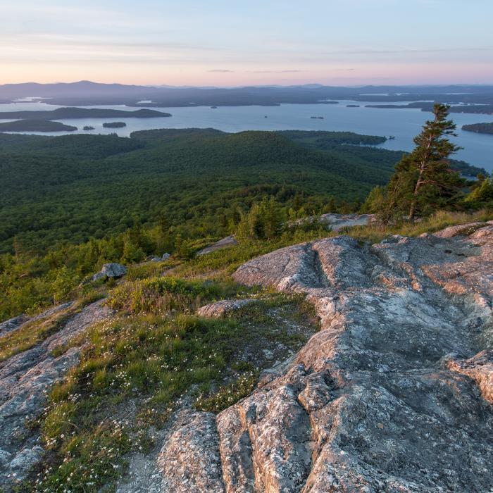
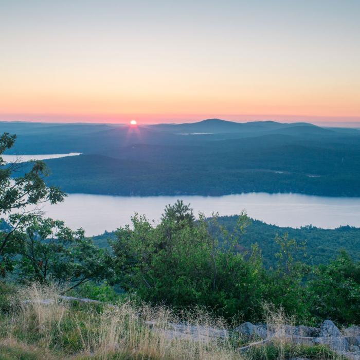
At 1,786 feet, the summit of New Hampshire's beloved Mount Major offers views that are among the best in the southern part of the state for the effort required. It's part of a 200-acre conservation area owned and managed by the Society for the Protection of New Hampshire Forests that will forever be protected from development.
A signed parking area on NH Route 11 in Alton welcomes you to the Mt. Major trail network that leads to the summit of Mt. Major and other hiking destinations in the Belknap range.
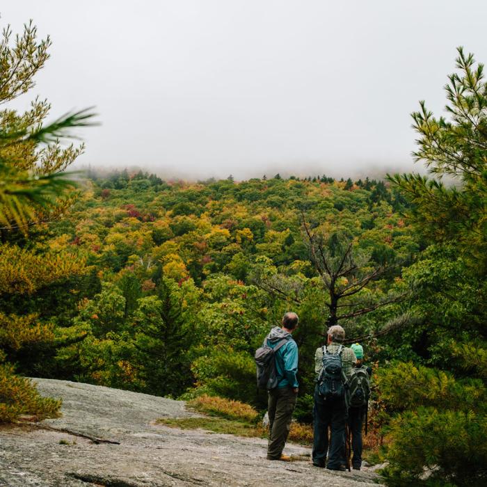
Multiple trails (Mt. Major/Main Trail, Brook Trail, and Boulder Loop) lead to the summit providing options for a round trip hike ranging from 3 to 3.9 miles. Be aware that the upper ledges are steep and dangerous in wet or icy conditions. The Brook Trail is a good alternative route in such conditions and an option for a more gradual descent that offers views from the open west ridge that are not duplicated by the Mt. Major/Main trail.
Portable toilets are available year-round. Please treat these facilities with respect – they are not trash cans! Mt. Major is a carry in-carry out location. Please take all your trash home with you, including dog waste!
If you are planning to visit with a group of 15 or more, please visit this page and register in advance. Here's more about what to know before you go.
Give back to the trails you love!
This summer, we upgraded the Main Trail at Mt. Major to make it more sustainable. Make a donation here.
Property Details
A Conservation Success Story
A coalition of organizations, led by the Society for the Protection of NH Forests, the Lakes Region Conservation Trust, and the Belknap Range Conservation Coalition, successfully raised $1.6 million to conserve key parcels of land on and surrounding Mt. Major in 2015. This is the first step in the long-term stewardship of this iconic mountain, and the Forest Society is still working to protect additional lands and trails on Mt. Major!
Trail Information
Main/Mount Major Trail
Blue blazes
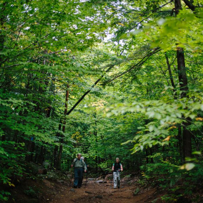
The Main/Mount Major trail is 1.5 mi one way and is the shortest route to the summit. This trail leaves the right side of the Mt. Major parking lot and follows an old logging road, ascending a steep, eroded section where several paths diverge and rejoin. Stay farthest to the right (ascending) to follow the trail and find slightly better footing. At the top of this steep section, at 0.3 mi., the road becomes nearly level and smooth. At 0.7 mi. is the junction of the Main Trail (blue) and the Brook Trail (yellow). Bear left to stay on the Main Trail to ascend to steeper ledges before reaching the summit. There are three main sections of steep ledges as you climb to the upper slopes of Mt. Major. At several points it is possible to by pass the steepest pitches on alternate paths that rejoin and lead to the summit. The summit, with ruins of a stone hut called "Mr. Phippen's Hut", is 1,786 feet above sea level, a gain of 1,136 feet from the parking lot below.
A large parking area with sign is on NH Route 11, 4.2 miles north of Alton Bay.
Brook Trail
Yellow blazes
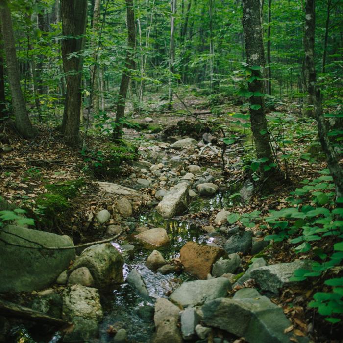
The Brook Trail is 1.7 mi one way. Take the Main/Mount Major Trail and continue on the logging road where the Main/Mount Major Trail diverges to the left, 0.7 mi from the parking lot. There are other diverging roads along this trail but none are as obvious as the yellow blazes on the Brook Trail. At 0.5 mi. the road appears to end, but a lesser woods road bears right toward a small brook, crosses it, and continues to climb through a hardwood forest, with loose footing on some eroded sections. At 0.9 mi. the trail swings left away from the edge of the valley and climbs to the saddle between Mt. Major and Straightback Mtn. At 1.2 mi, the trail meets the Belknap Range Trail. Here the two trails join together and turn left to climb mostly over open ledges with good views to the summit. Reach the old stone hut and summit at 1.7 mi.
Boulder Loop Trail
Orange blazes
The Boulder Loop Trail is 1.6 mi one way. This trail leaves the left side of the parking lot and provides a route up the south side of the mountain. The lower section follows a snowmobile trail that crosses two plank bridges and in 30 yd. turns right up a bank past a boulder where a woods road continues ahead. It climbs moderately up a woods road also used as a snowmobile trail to a T-juntion at 0.4 mi. Here it turns right, then in 40 yd. bears left a a fork, where orange blazes begin, and ascends south along the woods road. The trail leads to a boulder field and continues between and under boulders until it climbes to a steep gravelly pitch. At the top of the pitch the trail turns right, then left and runs at easy grades through an oak and pine forest. The trail ascends gradually over open ledges with increasing views east and south, to the summit. To use this trail on the descent, walk south across the ledges from the stone hut and look for orange blazes on the rock.
Trail descriptions adapted from the Southern New Hampshire Trail Guide 2nd Edition by Gene Daniell and Steven D. Smith, published by the Appalachian Mountain Club in 2005.
Recommended Properties Nearby

A network of trails starts from Avery Hill Road, including a 1.7 mile marked loop trail that winds through fields and forests to reach the top of Pine Mountain. The trail traverses the Avery Field near the site of the former Avery Farm and ascends the west slope of Pine Mountain. Open blueberry barrens at the summit provide spectacular views of the entire Belknap Range, including Mount Major and Lake Winnipesaukee, as well as excellent berry picking in season.
The land was first settled as farmland in the 18th century, as evidenced by the cellar holes, cemeteries, cleared fields, and old farm house that was removed from the property. The land also became a source of forest products for much of the last century.