

About the Property
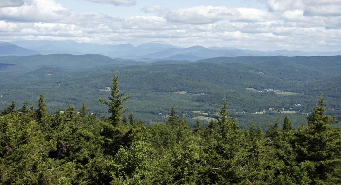
The Eagle Cliff Trail leads to Eagle Cliff, a rocky overlook with views of Squam Lake. A more ambitious hike beyond Eagle Cliff will bring you to the Red Hill Fire Tower lookout.
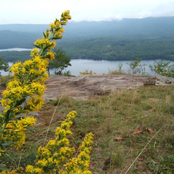
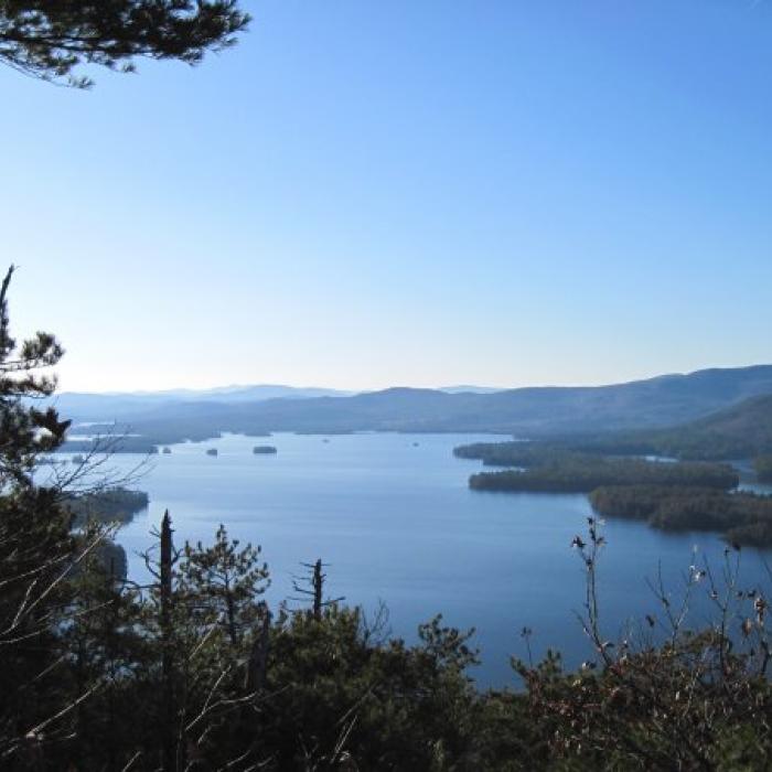
Eagle Cliff commands one of the finest views in the Squam Lakes Region. The view northwest to east-northeast encompasses most of Big Squam Lake and its many tiny islands, along with the formidable Squam Range looming above and behind. On the opposite shore, the twin hills of the Rattlesnakes are visible, as well as the summits of Mts. Morgan and Percival. Looking further to the east, the high peaks of the Sandwich Range appear rugged and majestic over the town of Sandwich. The huge south-facing ledge on Mt. Whiteface is visible just to the left of the hulking mass of Mt. Passaconaway, and further east the rocky spire of Mt. Chocorua rises abruptly over the lowlands of Tamworth. To the northwest, Mt. Cardigan and its fire tower can be seen in the distance.
Please see our Visitor Use Guidelines page for a complete list of rules and regulations for Forest Society reservations.
Property Details
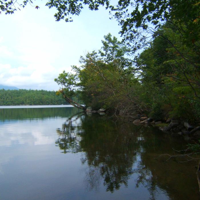
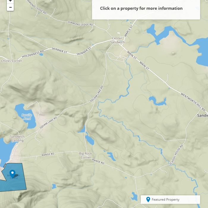
A hiking trail maintained by the Squam Lakes Association runs over this property, offering nice views of Squam Lake. There is no designated parking area or kiosk at the Eagle Cliff Forest. Parking for the Eagle Cliff Trail, which traverses the property, is along Bean Road, where there is a sign specifically for the trail. Look for a wide shoulder on the east side of the road just north of where Bean Road passes between a red farmhouse and barn. The Eagle Cliff trail sign is slightly below the level of the road. The Forest Society does not plow or guarantee access to this property or its parking areas during the winter.
Trail Information
Eagle Cliff Trail
Yellow Rectangles
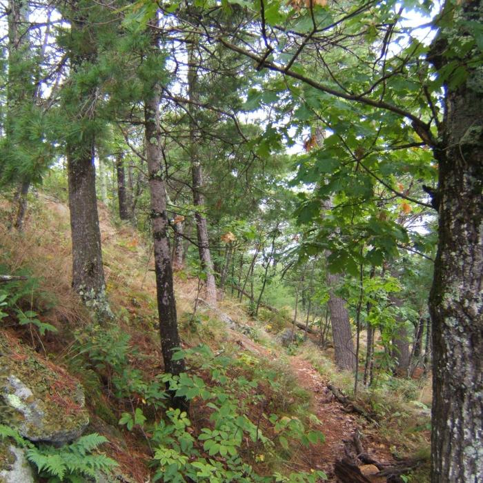
Maintained by the Squam Lakes Association, the Eagle Cliff Trail climbs 600 feet in ½ mile to open ledges that offer sweeping views west across Squam Lake and north to the Sandwich Range of the White Mountains. The trail begins on the east side of Bean Road in Sandwich just north of the Moultonborough/Sandwich town line. The start of the trail is not on Forest Society land, so please stay on the trail. At .3 mile the trail divides at the lower ledges. The right fork offers a more gradual climb around the base of the lower ledges, making a wide detour around the most difficult part and rejoining the main trail after .2 miles. This is the best route in wet or icy conditions. The left fork climbs steeply .1 mile up the cliffs, requiring some hand-over-hand scrambling, then rejoins the right branch. From this upper junction, the trail ascends the ledges, angling to the left to reach the main viewpoint on Eagle Cliff at 1,200 feet elevation and .5 miles from the road. (The rock scrambles on the upper part of the main trail can pose problems to even seasoned hikers, especially on the decent.) The trail ascends another ledge that offers additional views, then descends slightly to a flat area at 1.0 mile, where it joins the Teedie Trail. From here hikers may choose to descend down the Teedie Trail, which comes back onto Bean Rd. about .4 mi south of the Eagle Cliff Trail, or to continue along the Eagle Cliff Trail to the fire tower.
Recommended Properties Nearby
Three different paths lead to the summit of Green Mountain, where you’ll find the fire tower that’s part of the Green Mountain State Forest, a block of land at the summit surrounded by the High Watch Preserve.