

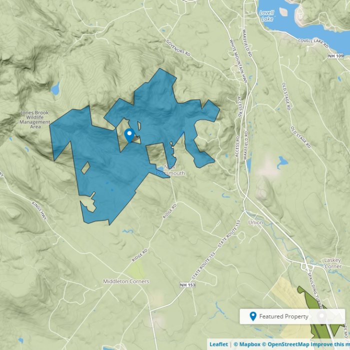
About the Property
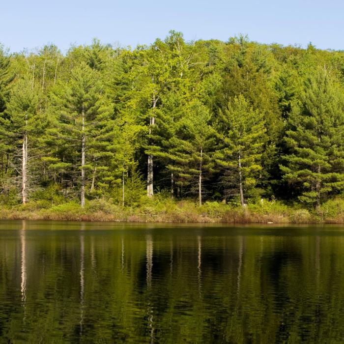
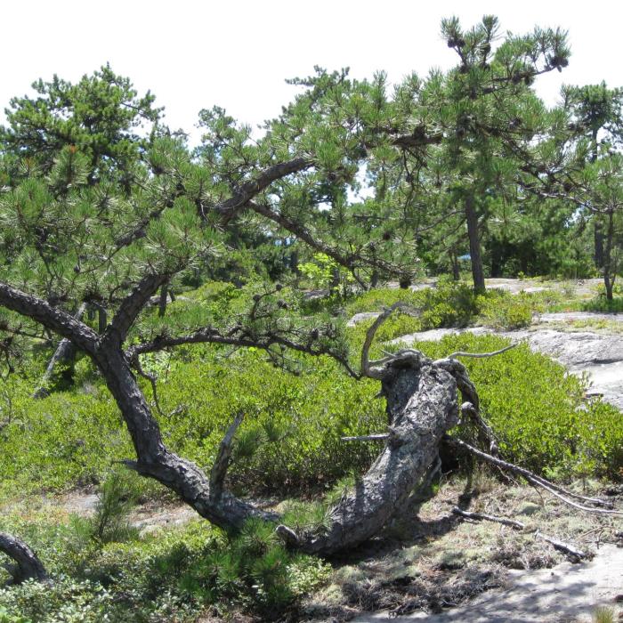
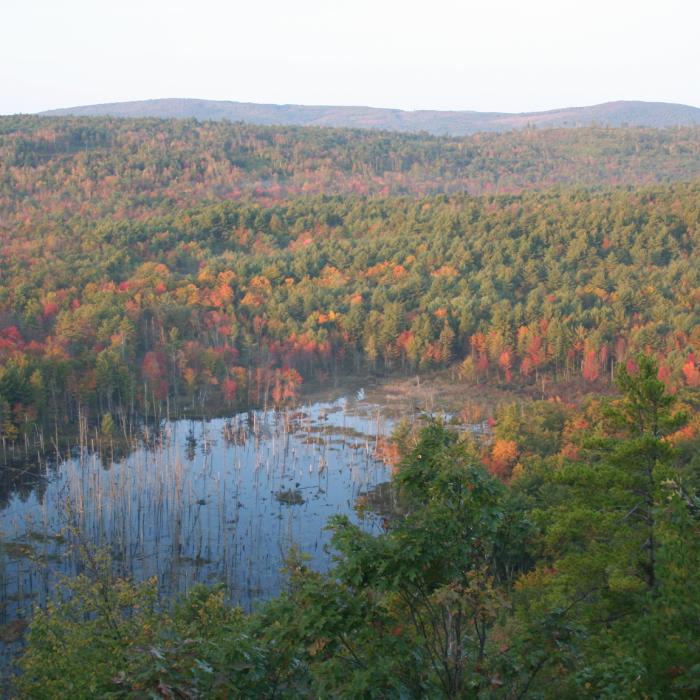
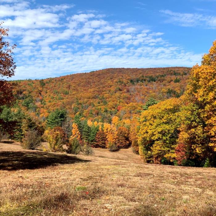
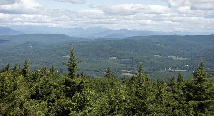
Find sweeping views, cellar holes, and centuries-old cemeteries at this nearly 2,800-acre reservation that boasts more than eight miles of trails, woods roads, and snowmobile corridors. A popular outing is the 1.2-mile round-trip hike to the small peak called Phoebe’s Nable, which features a rare view of one of southern New Hampshire’s unbroken forested landscapes. Amazing views from Beauty Ledge also await off the North Trail. Pockets of unusual pitch pine forest habitat can also be found along the trail. Another highlight is the heron rookery – vacated, but you never know when they’ll be back. Take the Piper Mountain Trail to the height of land, then look for a spur trail off the south side that leads to the top of Piper Mountain for views down to the marsh with the rookery. To extend your outing, many other out-and-back and loop trail adventures await off the Burrows Farm Trail.
For more information, check out the Moose Mountains Reservation Facebook Group . Another interesting source of information can be found at Steve Smith's "Mountain Wanderings" blog page.
Please note: Some trails that are not shown on our property map.
Please see our Visitor Use Guidelines page for a complete list of rules and regulations for Forest Society reservations.
Property Details
Historical uses:
The area was first settled as farmland in the 18th century, as evidenced by the cellar holes, cemeteries, cleared fields, and old farm house that was removed from the property. The land also became a source of forest products for much of the last century. The frequent timber harvests encouraged lush early successional growth that supports moose and other large mammals that thrive on the property. The return of the forest also shaded and protected the three streams that flow from the property to join the Salmon Falls River, which ultimately flows into the mighty Piscataqua River and on to the Atlantic Ocean. Water quality research indicates that the Branch River headwaters in the Moose Mountains is one the largest and most pristine watersheds in coastal New Hampshire.
Circumstances of acquisition:
Protection of this property began in 2003 when the Forest Society partnered with the Moose Mountains Regional Greenways to obtain funding from the federal Forest Legacy program. In 2005 additional funding was obtained from the federal Coastal and Estuarine Land Conservation Program. Support from Senator Judd Gregg, the State Forest Legacy Committee, the NH Division of Forests and Lands, Moose Mountains Regional Greenways, combined with contributions from hundreds of generous private donors enabled this project to be completed in 2006.
Trail Information
Old Burrows Farm and Phoebe's Nable
None
From the parking lot, continue up the Burrows Farm Trail to the junction with North Road. Bear left at the junction; continue for approximately 1/3 of a mile. Turn left and cross the bridge, continuing through the woods to a field, passing a cemetery on your right. Continue south through the field. Continue into the woods, looking for the Phoebe’s Nable spur to the left. The 1/4 mile spur trail leads to the wooded top of Phoebe’s Nable (1,185 ft), which offers partial views to the south.
North Road Trail
None
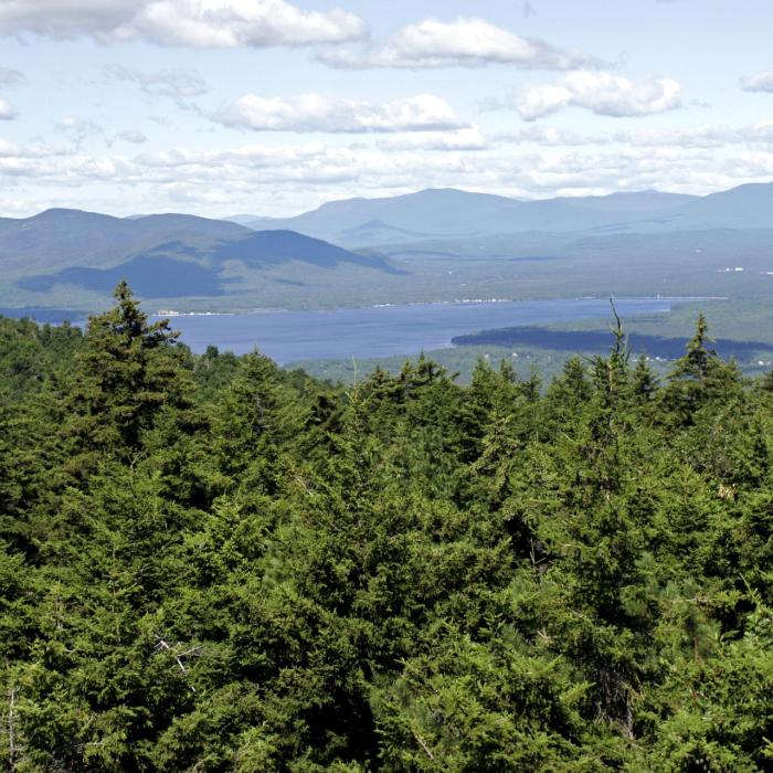
From the parking lot, continue up the Burrows Farm Trail to the junction with North Road. Turn right on North Road; continue for approximately 3/4 of a mile to an open clearing. (The Mountain View trail is to the west.) Head toward the edge of the woods to the north, looking for the break in the woods where the North Road Trail continues. The North Road Trail crosses the Branch River and ascends to the right just over the Branch River bridge. Continue approximately 3/4 mile on the North Road Trail to an opening on the north side of the mountain that offers views of Mt Chocorua, Mt. Washington, and the White Mountains.
Piper Mountain Trail
None
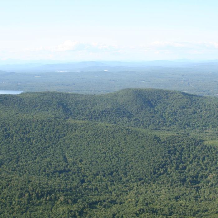
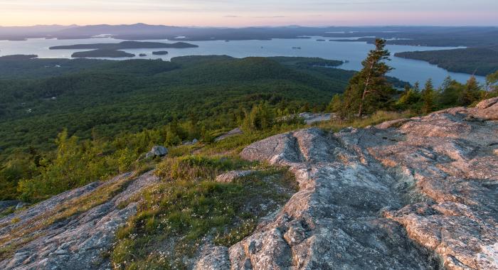
From the parking lot, continue up the Burrows Farm Trail to the junction with North Road. Turn right on North Road; continue approximately 1/8 of a mile to a clearing off to the right. The Piper Mountain Trail begins at the far (south) side of this opening. The trail goes downhill, curving sharply to the left. Continue to a junction. Bear left at the junction, heading northeast past Bowser Pond (on the right). The Piper Mountain Trail ends in a T at the unpaved Piper Mountain Road, which circles the Middleton Town Forest. Turn right onto Piper Mountain Road; continue approximately 1/3 mile. Look for the spur trail to the right. The 1/8 mile spur trail leads over the open summit of Piper Mountain to rocky ledges with views to the south, overlooking a heron rookery.
Recommended Properties Nearby
*Note: A timber harvest is taking place on this property through the fall. Visitors to High Watch that are wishing to hike the High Watch Trail off High Watch Road will need to adhere to the proper places to park their vehicles in an effort to avoid blocking access by logging equipment. The trail will remain open but please exercise caution around equipment and keep a safe distance away. To learn more about this and other forest management projects, visit Recent Forestry Projects or Cutting for Conservation.*
Three different paths lead to the summit of Green Mountain, where you’ll find the fire tower that’s part of the Green Mountain State Forest, a block of land at the summit surrounded by the High Watch Preserve.
A network of trails starts from Avery Hill Road, including a 1.7 mile marked loop trail that winds through fields and forests to reach the top of Pine Mountain. The trail traverses the Avery Field near the site of the former Avery Farm and ascends the west slope of Pine Mountain. Open blueberry barrens at the summit provide spectacular views of the entire Belknap Range, including Mount Major and Lake Winnipesaukee, as well as excellent berry picking in season.