


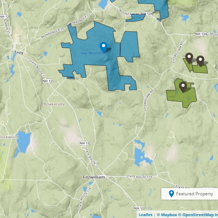
About the Property
*Note: The Donovan Memorial Trail and parking area will be closed from 7/22/24 to approximately mid-October 2024 due to a forest management project. The Gap North and Gap South parking areas and trails will remain open. (To learn more about this and other forest management projects, visit Recent Forestry Projects and Cutting for Conservation.)*
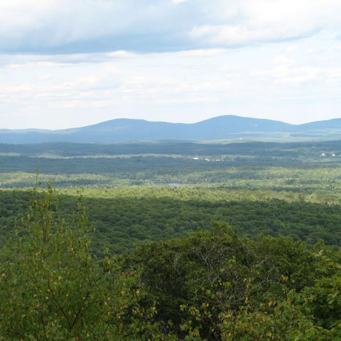
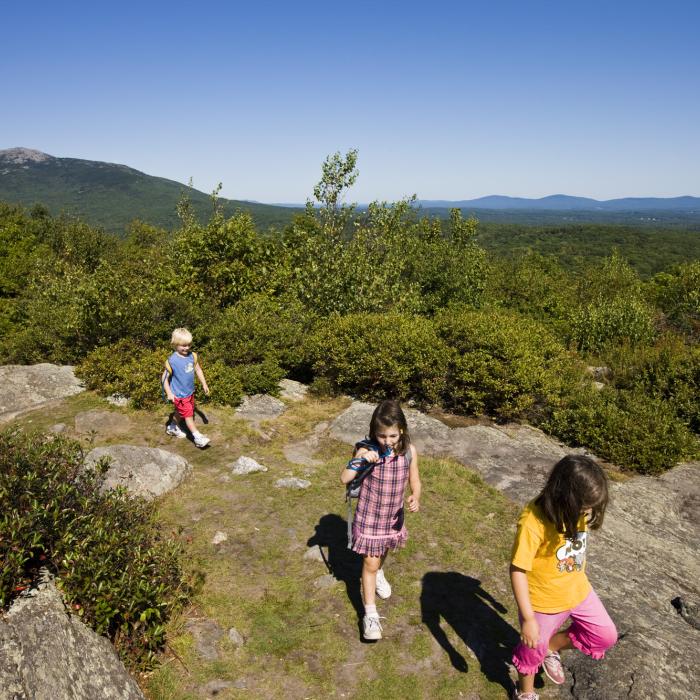
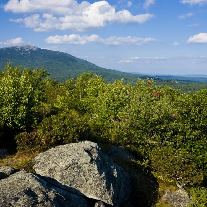
Enjoy breathtaking views of Mount Monadnock and beyond from Gap Mountain’s middle and north summits. Aptly named for the prominent “gap” between its middle and south (no view) summits, Gap Mountain (1,862’) is one of the most popular hiking destinations in southern New Hampshire and is well known for its abundant and delicious blueberries that grow on the summits in July and August. The property’s primary trail coincides with the long-distance Metacomet-Monadnock Trail, which provides a direct link to reach the summit of Monadnock by foot.
Please see our Visitor Use Guidelines page for a complete list of rules and regulations for Forest Society reservations.
Property Details
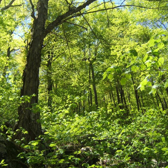
The forest on Gap Mountain is a legacy of extensive farm pastures which formerly extended over the entire mountain, including the summit. Today, the lower slopes of Gap Mountain are covered in second-growth forest of white pine and red oak. The remains of a former apple orchard can be found along the main hiking trail from the Jaffrey trailhead on the east, which crosses the historic stonewall-lined Gap Mountain Road. Gap Mountain Reservation is leased to the State of NH and is managed as part of Monadnock State Park.
During the 1930s and 1940s, a substantial part of the northerly portion of Gap Mountain, Carboni Pasture, was owned by a cattle and horse dealer. It was purchased with other adjoining land by investors who eventually incorporated themselves into the Gap Mountain Company.
The Gap Mountain Company initially planned to develop the mountain for 50 house lots and an exclusive ski tow, but eventually put the land up for sale. In 1973 a dedicated group of local citizens formed the “Friends of Gap Mountain” (FOG) organization in hopes of preventing the mountain from being developed. Their fundraising efforts combined with a major gift from an anonymous donor enabled the Forest Society to purchase a 636-acre tract in 1974.
Later that year, a 110-acre tract spanning the south slope of Gap Mountain in Troy was donated to the Forest Society by Jane Fiske. Her father John Noble, a Boston lawyer and one of New Hampshire’s early conservationists, had purchased the property in the 1920s to prevent it from being developed into a hotel. To acknowledge his foresight in conservation, the land was designated in his memory as the John Noble Memorial Reservation.
In 1986 Albert Gins from New Jersey donated 40 acres to the Forest Society– including the top of one of the peaks of the mountain. The following year, John T. and Joan B. Tyler purchased 20 acres and subsequently turned them over to the Forest Society to add to the reservation.
The Forest Society gratefully acknowledges the efforts of landowners and local citizens who have helped protect and preserve this important scenic landmark.
Trail Information
Ascent from the North Parking Lot
White Rectangles
There are 3 summits on Gap Mountain. The south summit is wooded with no views. (The “gap” in Gap Mountain is between the south and middle summits.) Both the middle and north summits have excellent views of Mount Monadnock and the surrounding country.
From the North parking lot, it is a 2.4 mile round-trip hike to Gap Mountain’s north summit and back. This is a strenuous hike over steep terrain, so please be sure you have sturdy footwear and plenty of water. Follow the trail that leaves from near the kiosk, and almost immediately you will come to the Metacomet Monadnock/Royce Trail (white blazes). Turn to the RIGHT (west) here, making sure you are on the white blazed trail and follow the white blazes all the way to the summit of Gap Mountain. Be sure to turn left off the Metacomet-Monadnock Trail and back to the parking lot on your return trip.
Ascent from the South Parking Lot
Yellow Rectangles from the parking lot to M/M trail, then White Rectangles to Summit
There are 3 summits on Gap Mountain. The south summit is wooded with no views. (The “gap” in Gap Mountain is between the south and middle summits.) Both the middle and north summits have excellent views of Mount Monadnock and the surrounding country.
From the south parking lot, it is a 2.6 mile round-trip hike to Gap Mountain’s middle summit and back. This is a strenuous hike over steep terrain, so please be sure you have sturdy footwear and plenty of water. From the South parking lot, follow the yellow blazed trail 0.4 mile to where the trail merges with the Metacomet Monadnock Trail (white blazes). Continue straight ahead on the M/M trail, following the white blazes, emerging on the middle summit at 1.3 miles. If you wish to visit the north summit, follow the white blazes down into a swampy area and then back up to the summit (0.1 miles beyond middle summit). NOTE: On returning to the parking lot, remember to look for the yellow blazed trail to the parking lot on the left just after crossing the stream.
Wantastiquet-Monadnock Trail
Various
The 50 mile Wantastiquet-Monadnock Hiking Trail (WMT) can now be hiked over its whole length from Brattleboro to Mt. Monadnock. Download maps of the trail and five section hikes.
Recommended Properties Nearby

Mount Monadnock is one of the most-climbed mountains in the western hemisphere.
The Madame Sherri Forest is named after a former owner, Madame Antoinette Sherri, a Paris-born theatrical costume designer who worked in New York City during the early 1900s.
These lands had been in the Heald family for more than a century and are collectively known as the Heald Tract. They had historically been well managed by the Healds for multiple uses, including apple orchards, wildlife habitat, forest products, passive recreation, education, and flood control.