A tour with Leadership Greater Nashua
- Tags:
- Education,
- Land Conservation

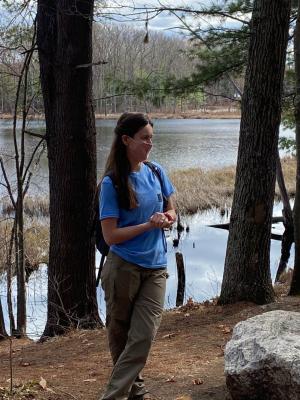
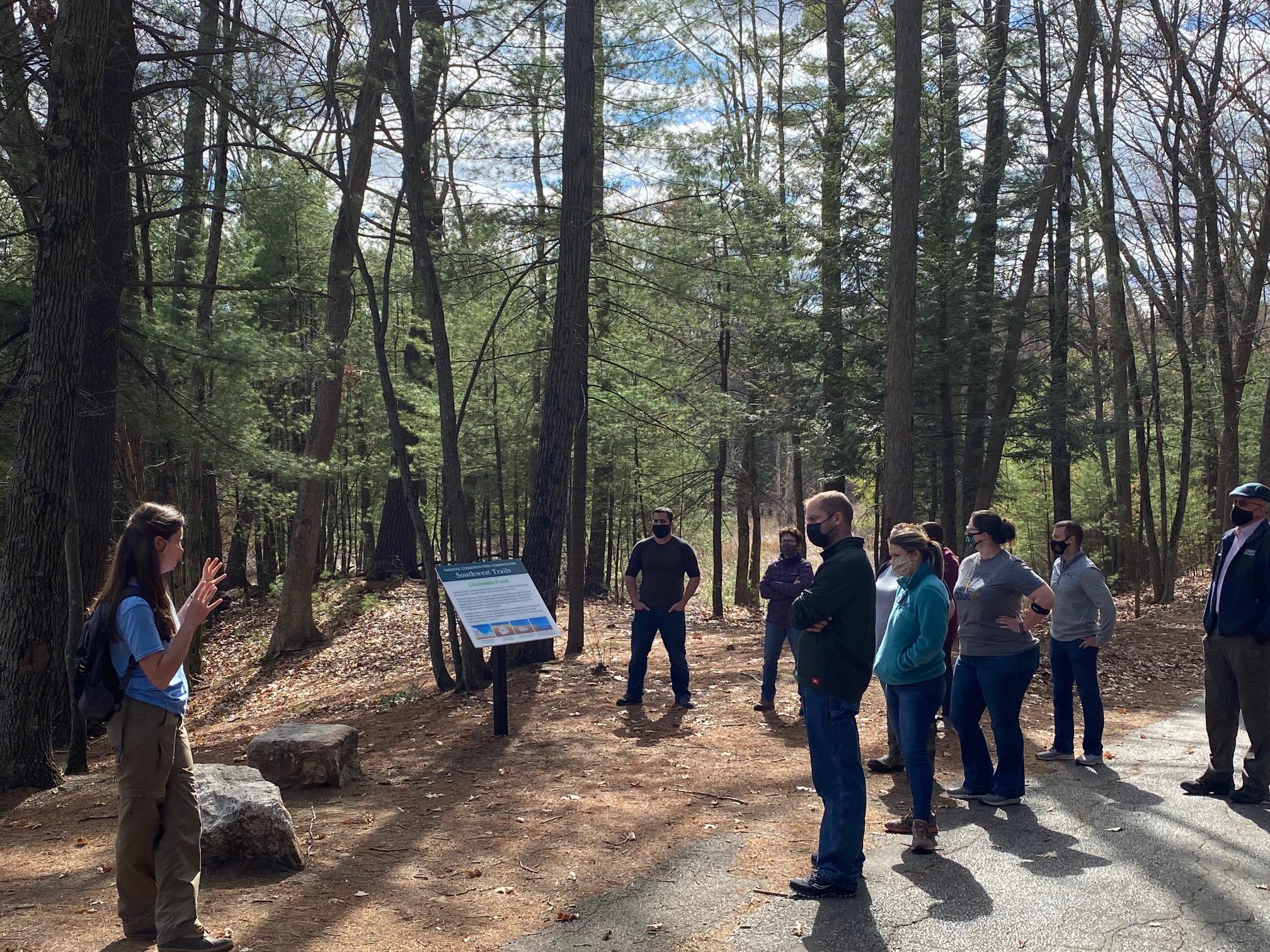
Forest Society Easement Steward Stacie Hernandez shares the conservation story of Lovewell Pond in Nashua with the participants in Leadership Greater Nashua.
Masked and socially distanced, yet happy to be together outdoors in the warm April sunshine, a group of professionals enrolled in the 2021 Class of Leadership Greater Nashua recently toured trails on the City's Southwest Trails network along scenic Lovewell Pond. Forest Society Conservation Easement Steward Stacie Hernandez and Senior Director of Education Dave Anderson guided a walk to talk about land conservation, conservation easement stewardship, wildlife habitat, community recreation values and a little glacial geology.
Lovewell’s Pond is the headwaters of Cold Brook, which traverses through the Old Ridge Road wetlands, listed as prime wetlands with the State of NH. The assessment indicates that Lovewell’s Pond and adjacent wetlands have a very high flood control potential. The pond and associated wetlands also provide significant protection for the stratified drift aquifer as delineated by USGS. Lovewell’s Pond also has great educational potential being a short distance from Main Dunstable Elementary School. Old Ridge Road, recently closed by the City to through traffic to better protect the pond, provides an excellent opportunity to walk along the pond and reach its edge. The variety of habitats, including bog, pond, beaver dam and forested upland, offer additional opportunity for study.
In 1995, the City of Nashua updated its Master Plan for the Southwest Quadrant and began work to acquire open space in the Southwest Quadrant through donation and fee purchases. By 1999, the City had begun to reach some land conservation goals. A 127-acre parcel was donated to the City, which also passed a bond initiative for $2.6 million to purchase several tracts of land including one near Lovewell’s Pond. The combination of these transactions has resulted in over 557 acres of contiguous land in City ownership. Some of the city land will be devoted to ball fields and play grounds. However, the City of Nashua under the leadership of then-City Counsellor Kathy Hersch asked for the Forest Society to accept a conservation easement on approximately 170 acres surrounding Lovewell's Pond to ensure that it remain in conservation and for passive recreational use in perpetuity. The easement represented a unique opportunity to preserve the entire shoreline and much of the watershed of the 16 acre pond, in one of the last undeveloped areas of the City.
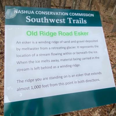
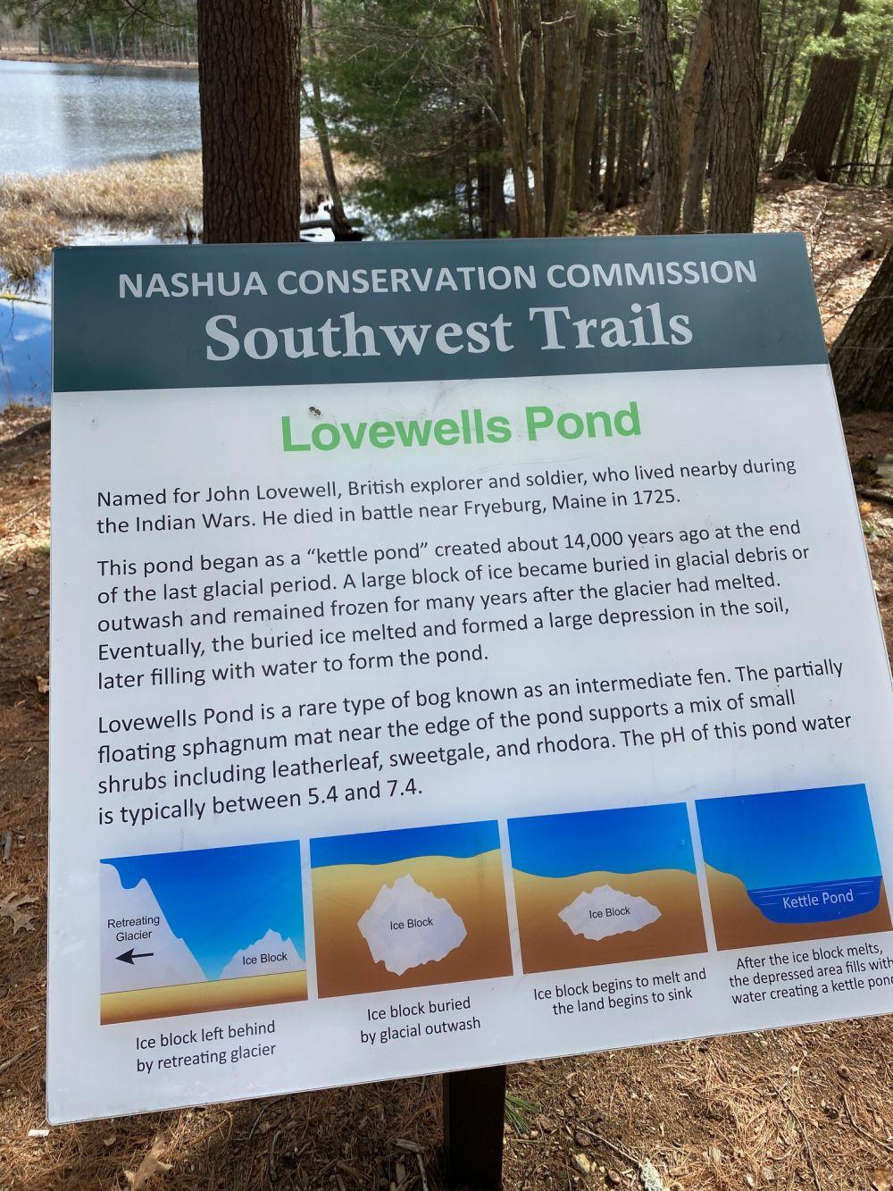
The City of Nashu has permanently conserved the unique natural resource and its adjacent wetlands and uplands to every extent possible. The NH Natural Heritage Inventory determined that Lovewell's Pond is unique in Nashua and rare in the State. They identified Lovewell’s Pond as a kettlehole bog. Nearby across ridge road is the elevated ridge of glacial gravel and debris known as an "esker" a glacial feature formed approximately 14,000 years before present during the last glaciation.