

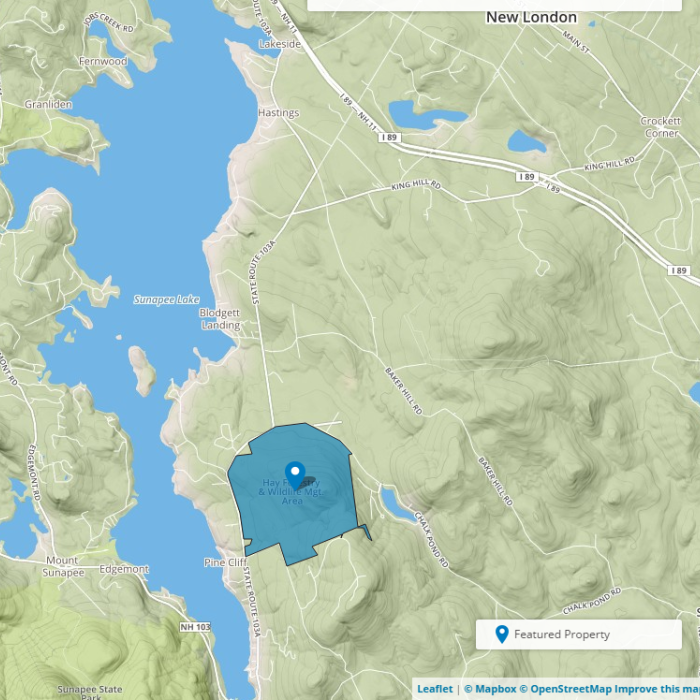
About the Property
Reward yourself with beautiful views of Lake Sunapee and Mount Sunapee after climbing to the 1,831 foot summit of Sunset Hill at the Hay Reservation. The property abuts other protected lands, including the historic Hay Estate at The Fells (see their public programming schedule), the John Hay National Wildlife Refuge, and the New Hampshire Audubon Society’s Stony Brook Sanctuary.
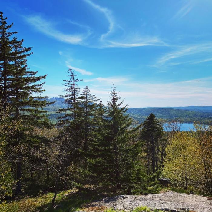
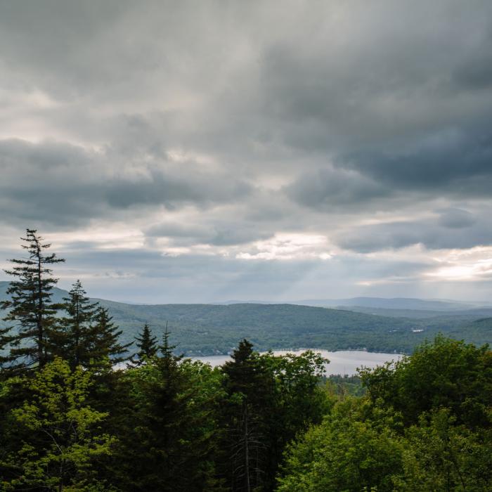
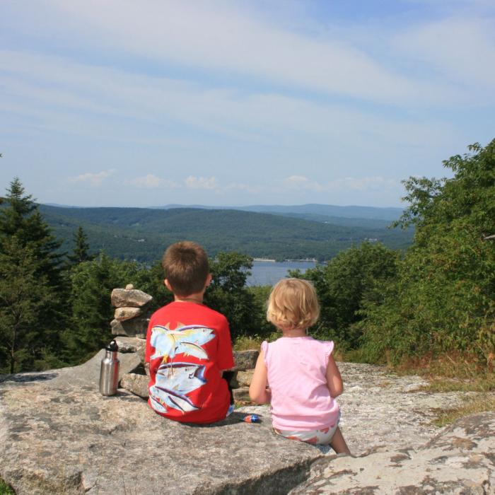
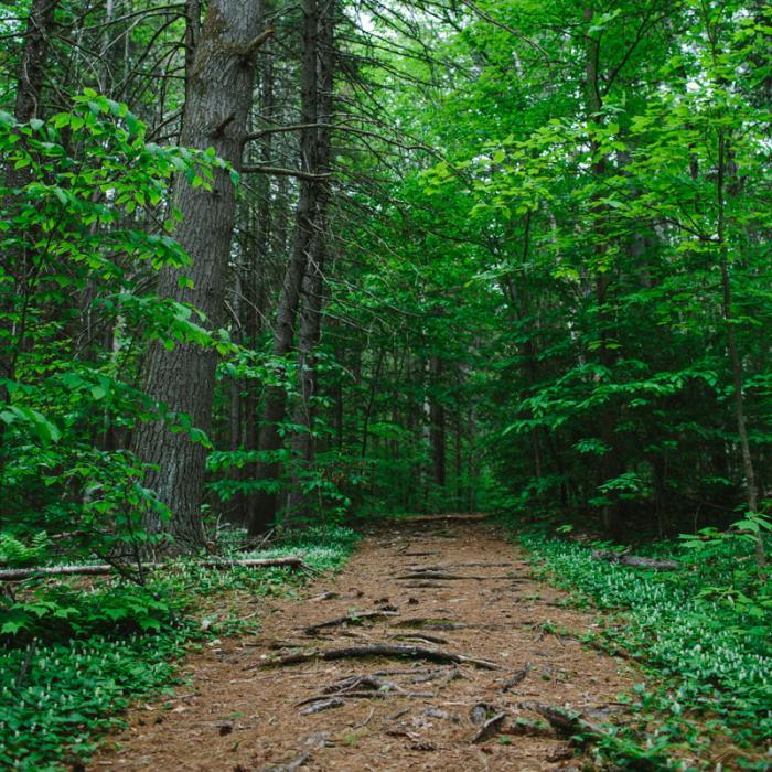
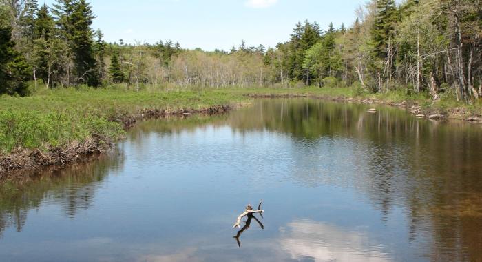
The Hay Forest Reservation in Newbury offers nearly four miles of excellent hiking along interior roads and trails that wind through the pine, red oak, spruce, hemlock and northern hardwood forests growing back on former hay fields, sheep pastures, and orchards. Sunset Hill offers sweeping views of Lake Sunapee, Mount Sunapee, Kearsarge, and distant peaks of the White Mountains.
The legacy of the historic hill farm originally purchased by Secretary of State John Milton Hay is evidenced in the woods today. Bisecting the property, Old County Road is flanked by stone walls. Faint interior roads are scored by ancient wheel ruts, which lead to the hidden cellars of forgotten farms with stone-lined wells.
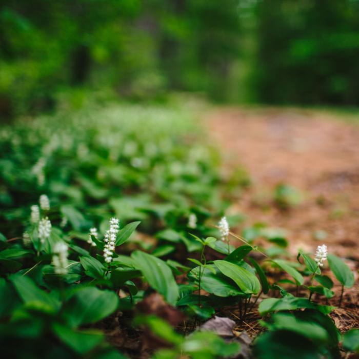
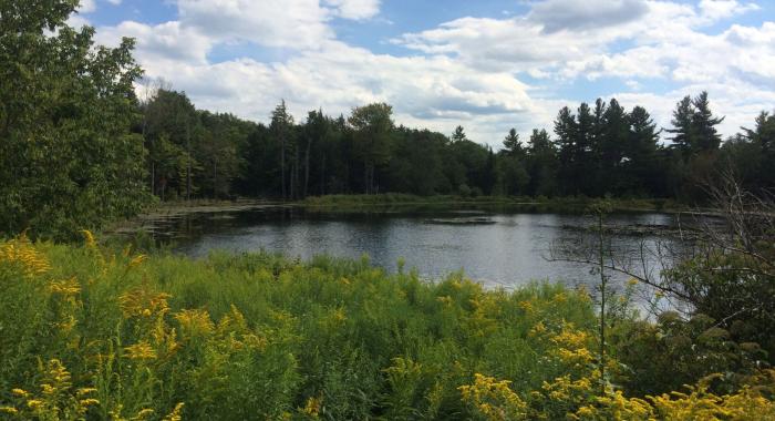
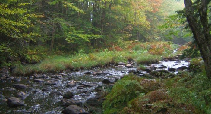
A mixed beech, birch, and hemlock forest shades the headwaters of west-running Beech Brook, a sparkling necklace of clear pools where tiny jewel-like brook trout live. Pockets of rich soil nourish a colorful carpet of wildflowers growing under white ash and sugar maples in the spring. In summer, hikers might find scat from the resident black bears or red foxes that feed on pin cherries, blueberries, blackberries, raspberries, or mountain ash berries. In winter hikers follow tracks of moose, deer, coyote, bobcat, fisher, otter, mink, and hare from the shadowy spruce forest along the upper portion of the Sunset Hill trail to the white pines of former pastures along the Old Farm Road trail.
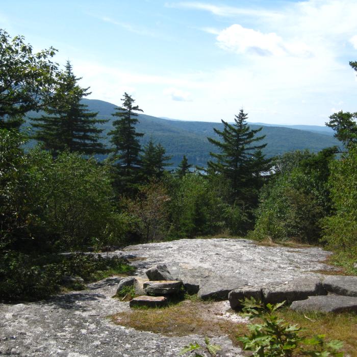
The most-popular hiking trails ascend Sunset Hill. Ledges surrounding the partially-open summit of Sunset Hill provide views of 11 mile-long Lake Sunapee, Mount Sunapee, and distant peaks in the Green Mountains of Vermont. A side-trail leads to a cleared vista with views north to Mount Kearsarge and New Hampshire's White Mountains.
The Hay Reservation is near other protected lands including the historic Hay estate at The Fells and the John Hay National Wildlife Refuge on the shore of Lake Sunapee and the Audubon Society's Stony Brook Sanctuary.
Visitor Use Guidelines
Please see our Visitor Use Guidelines page for a complete list of rules and regulations for Forest Society reservations.
Try an Outing on the Forest Society's Mobile App, Powered by OuterSpatial

Visitors to Forest Society reservations can now access information about land and trail maps easily from their mobile devices. Using the OuterSpatial platform, the Forest Society's mobile application is free and available for both iPhone and Android devices.
Hay Reservation Outing: This interpretive outing provides interesting information about the natural and cultural history of the area you are hiking through on the Sunset Hill hike.
Property Details
More than 100 years ago, the rugged natural beauty of Land Sunapee’s shores inspired American author and diplomat John M. Hay to build a summer retreat in Newbury. John Hay had been a private secretary to Abraham Lincoln and secretary of state under two presidents (William McKinley and Theodore Roosevelt). When he retired from public life, Hay wrote poetry and fiction and co-authored a ten-volume biography of Lincoln. John began buying land along Lake Sunapee in 1888 and built his summer cottage there. He named the nearly 1,000 acres of farm fields, bounded by stone walls and dotted with abandoned cellar holes, “The Fells” after the highlands of his ancestral Scotland. After his death in 1905, Hay’s son Clarence and Clarence’s wife Alice renovated the cottage and surrounding rocky pastures. They added walled terraces, fountains, gates, and paths among expansive lawns, orchards, and beautiful gardens of alpine plants. In its final form the estate had three distinct areas: the living area with the house and gardens, the farm area, and the 675-acre productive tree farm on Sunset Hill.
Circumstances of Acquisition
In 1960 the Hays donated their Sunset Hill property to the Forest Society “to manage … and for the public who will enjoy climbing Sunset Hill.” At the time, Clarence Hay wrote: “I would like to think of the property being useful, permanent and in capable hands and not broken up into tiny house lots.”
In 1987 Alice Hay bequeathed an adjacent 163 acres that includes the house, historic buildings, and gardens to the US Fish and Wildlife Service. The former farm is now in private ownership.
From the 1960s to the 1990s the Hay Reservation played a central role in the education and forestry programs offered by the Forest Society. The property was expanded in 1996 with the purchase of a key 37-acre in-holding on the north side of Sunset Hill that was named in memory of former Forest Society Trustee and New London banker William F. Kidder, Jr.
Trail Information
Sunset Hill Trail (from Route 103 trailhead)
yellow rectangles
There are excellent views of Lake Sunapee and Mount Sunapee from here. Elevation gain is about 550 feet.
Begin at the main trailhead on Route 103A, directly across from The Fells gatehouse parking area. The trail reaches a T about 500 feet past the trailhead kiosk – turn left here. The trail climbs gently for about 0.6 miles until it reaches Old County Road (an old farm road) running north-south through the Hay Reservation. Turn right here, and after about 350 feet, turn left towards Sunset Hill. The trail climbs more steeply for about .5 miles before reaching the rocky summit of Sunset Hill.
Sunset Hill from Kidder Tract Trail
yellow rectangles
There are excellent views of Lake Sunapee and Mount Sunapee from the rocky top of Sunset Hill. Elevation gain is 556 feet.
This trail is accessed from Chalk Pond Road 0.4 miles west of the junction with Route 103A. This route up Sunset Hill follows the remains of an old road for 0.3 miles, until a foot path enters the hardwood forest and travels 0.6 miles further to the summit of Sunset Hill.
Recommended Properties Nearby
***Note: All trails on Reney Forest are temporarily closed and are not expected to be open again until December 2024 due to a forest management project. To learn more about this and other forest management projects, visit Recent Forestry Projects or Cutting for Conservation***
Like much of the region, the slopes of Barton Hill were cleared for farm pastures and timber by the mid 1800s. The abandonment of hill farms allowed this land to gradually revert to a forest of poplar, white birch, and pine.