

- Tags:
- Climate
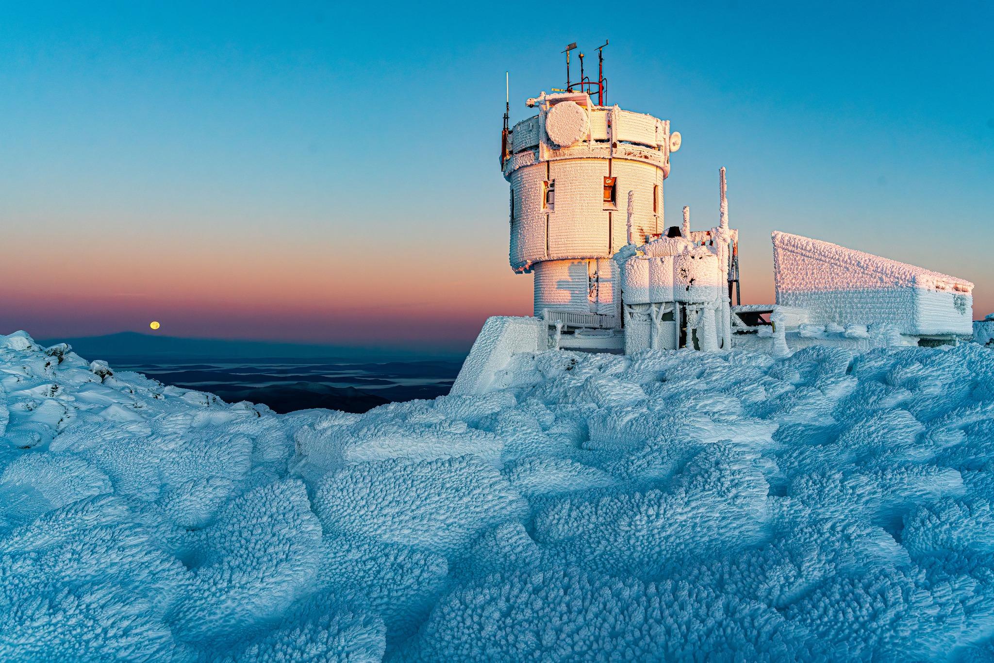
Courtesy Photo: Mount Washington Observatory/Charlie Peachey
As a native of Concord, New Hampshire, Charlie Peachey is no stranger to crazy New England winter weather.
Now, in his role as a Staff Researcher at the Mount Washington Observatory he’s focused on a weather phenomenon we might have all noticed is happening but not understood why, or how. “Rain on Snow” events are increasingly common in the New England region and can be generally defined as a weather event wherein precipitation falls in liquid form onto a snowpack of a specific volume.
Peachey was kind enough to spend some time talking with the Forest Society’s Sophie Oehler about the findings of his research, what the impacts of Rain on Snow events are, and what might be causing them to increase in prevalence.
Q: What were some of the motivations behind beginning this project?
A: The project began with anecdotal observations on ski season conditions over the last few years. We wanted to understand whether the characteristics of these Rain on Snow events are changing and if they are increasing in frequency. We’re hoping to find ways of predicting them so that local communities have more time to prepare for them before the actual event occurs.
Q: Why are these Rain on Snow events concerning for natural and human communities?
A: Well one reason is that these events contribute to an elevated avalanche risk. The rain creates a weak crust layer on the snowpack, or a rain crust. When new snow falls on top the rain crust, it can’t hold the weight, creating a slab avalanche. For mountain recreationalists these events will really alter the safety considerations of activities like back country skiing or winter hiking. Besides that, these events can cause significant damage to the local community’s infrastructure and economy, not only from the impact on winter tourism, but also the cost of addressing the damage.
For natural communities, some of the rare plants that inhabit the Alpine zone are small and more adapted to prolonged freezing conditions, not when the snow melts and refreezes over a short period of time. They also rely on the snowpack for insulation and heat retention, so if our snowpack is gone, so is their protection.
Plus, our water table is totally unprepared for the intense saturation that Rain on Snow storms create. There’s so much water being added to the cycle that it’s unable to penetrate the ground layer and be absorbed and held, instead creating an overland flow – a winter flood. Not only is that wreaking havoc on our infrastructure, but weakens our soils, damaging plant root systems and causing intense erosion.
Q: How do you see a consistency in these events impacting our winter weather in the future?
A: Over the past 10 years, we’ve had 40% more Rain on Snow events than we had between 1980 and 1990. The data shows such a steady increase, I would have to say we can expect these events to become more prevalent over time.
This means a thinner snowpack to start the season and a lot more flooding events in the winter. Plus, more mixed-weather events with either a lot of flooding and melt- out at the lower elevations, or colder temperatures after the rain causing refreezing and weak top crust layers. It’s going to affect our natural communities, and our ability to recreate outdoors in winter. It’s going to create less weather stability over time.
Q: Do you have an idea of why these events are becoming more common?
A: This is based on my own opinions and observations; but I’d say that the most significant trends in our climate change data is that the beginning of our winters is becoming warmer, which is likely what is causing these events to become more prevalent. Those warming patterns are the most devastating because they decrease the overall snowpack and the amount of water that is held in it, which we need during the summer to reduce drought conditions as it melts off.
Q: How concerned should we be about this change in weather patterns?
A: I’d say concern is elevating. More studies need to be done to either validate these results or get a better picture of what these events will look like in the future. I think more questions need to be answered before we start raising the alarm.
Q: What would some of those questions be?
A: The biggest one is trying to classify how a thick snowpack versus a thin one is going to influence these events. Will a thicker snowpack be worse because there’s more water being dispersed or will a thinner one be worse because there will be a faster meltdown of that snow? We’re not sure which yet.
Q: Is there anything that people can do to help researchers understand these events?
A: Learn how to become a citizen scientist! Take snow core measurements, especially if you go to the backcountry a lot. You can take a snow core to test for avalanches and then take another measuring snow/water equivalent data. Send your data to the National Weather Service or COCORAHS – the largest citizen science precipitation measuring group in the world – so they can use it in their own observations.
Q: What are we at risk of losing if these Rain on Snow events persist?
A: They affect such a wide variety of people, from all of us here at the summit, to the communities in the valleys, to recreationalists all over the mountains. The loss of snow will impact just about everybody, but especially these North Country communities where we’re very dependent on snow to sustain our economy and our livelihoods.
Q: Should we end on a happy note? What’s your favorite fun fact about the summit of Mount Washington?
A: We have two world records, one of them is the highest windchill ever recorded: 109 degrees below zero. And the other is we have the highest wind speed ever recorded by man in 1932: 241 mph. Me personally, I’ve seen the wind speeds get up to 147 mph here. I went out in that storm to knock the ice off our weather tower.