
About the Property
Lost River Gorge & Boulder Caves is open May through October each year. Learn more about the attraction, operated by White Mountain Attractions, that is located at the Lost River Reservation and requires tickets: MORE INFO.
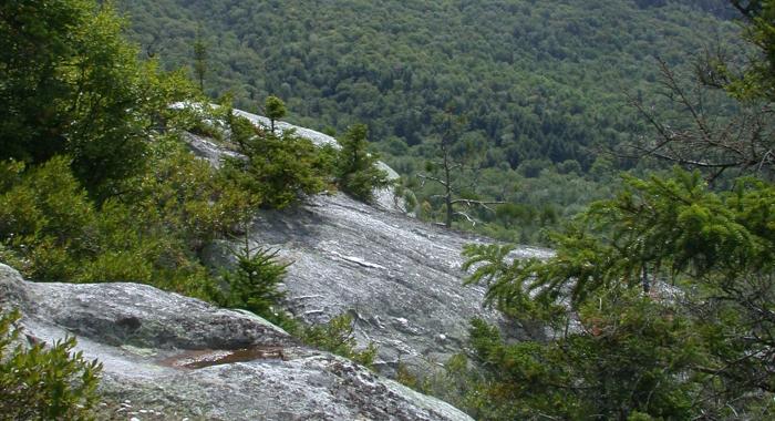
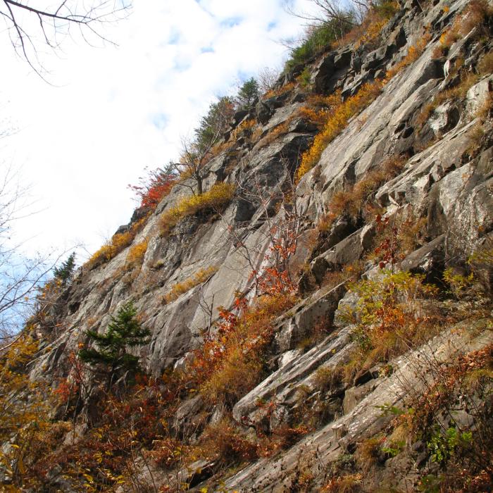
Alert: Due to a forest fire in October of 2017, the Dilly Cliff Trail has been closed permanently. The cliffs can only be reached from above by descending a short spur trail from the Kinsman Ridge Trail (Appalachian Trail) .
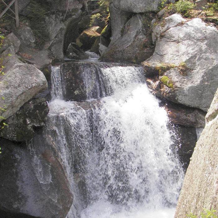
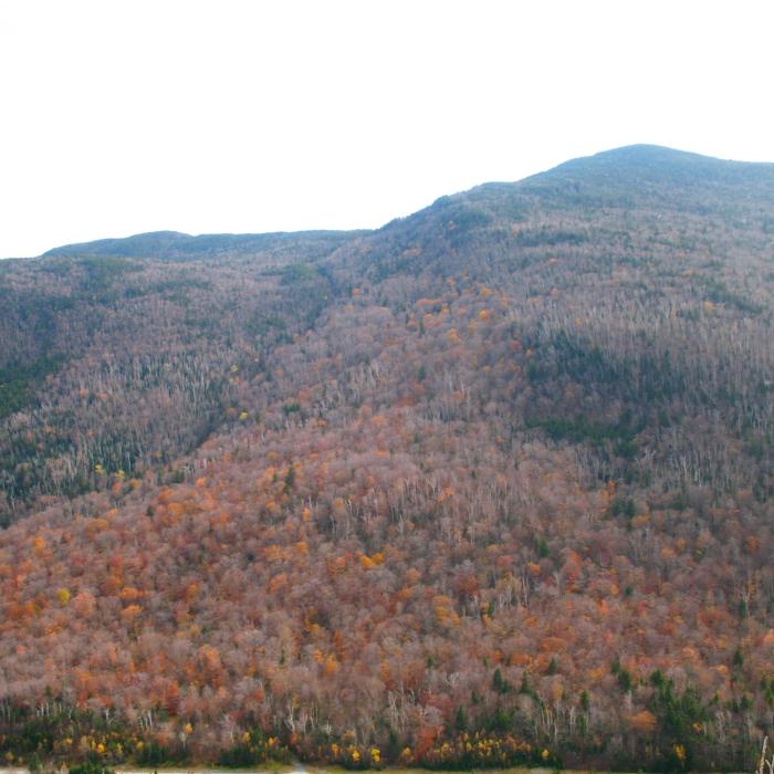
Located in the White Mountains town of North Woodstock, Lost River Reservation is set high in Kinsman Notch, one of the area’s most famous passes. Located between Mt. Moosilauke and Mt. Kinsman, Kinsman Notch is about 2,000 feet above sea level. Lost River is so-named because the brook draining from the southeast part of Kinsman Notch disappears below the surface in the narrow, steep-walled glacial gorge. The gorge is partially filled with immense blocks of granite, through which the brook cascades along its subterranean course until it eventually emerges and joins the Pemigewasset River.
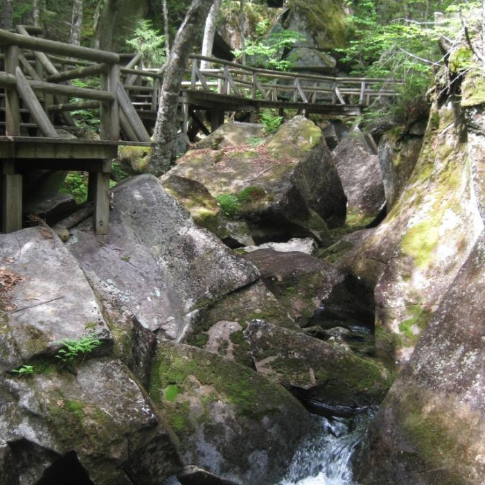
Today, the portion of the property that includes the gorge is leased to White Mountains Attractions Association, which provides guests with the opportunity to experience the fun, challenge, and excitement of the river, gorge, boulders and caves. Well-maintained boardwalks and staircases allow the public to access the gorge while providing the maximum amount of safety possible. Lost River Gorge welcomes thousands of visitors each year from all over the world. Visitors must pay a fee to enter the gorge; please visit the Lost River Gorge website for details. (New Forest Society members receive free passes to Lost River; if you're not already a member, please join and then come for an adventure!)
The Forest Society maintains the Lost River Ecology Trail on the Lost River Reservation, which is separate from the gorge area leased to White Mountain Attractions. This trail is free and open to public recreation from spring through fall. The trail is not accessible in late fall or winter, when the parking area for Lost River is gated and locked. The trails also close daily one hour before the gorge closes. Dogs are allowed outside the gorge fee area, but not inside it.
Try an Outing on the Forest Society's Mobile App, Powered by OuterSpatial
Lost River Outing: This interpretive outing provides interesting information about the natural and cultural history of the area you are hiking through on the Kinsman Notch Ecology Trail.
Property Details
Geologists estimate that approximately 300 million years ago, far beneath the surface of an ancient sea, mud and sand were heated and shifted, forming hard rocks such as Kinsman Quartz Monzonite and Pegmatite Dikes (types of granite). The mountains were being formed even then. Erosion before the Ice Age carved the Kinsman Notch area to approximately its present shape. The mile thick ice sheet, which covered all of New England from about 150,000 years ago until 25,000 years ago, furthered the erosion process. Turbulent water caused the movement of massive boulders. Acting like sandpaper, the moving sand and pebbles in the water smoothed the boulders and the mountain ridges.
Lost River is so-named because the brook draining from the south east part of Kinsman Notch disappears below the surface in the narrow, steep-walled glacial Gorge. The Gorge is partially filled with immense blocks of granite, through which the brook cascades along its subterranean course until it eventually emerges and joins the Pemigewasset River which flows south from Franconia Notch.
The first documented exploration of Lost River took place in 1852. Similar to Alice’s tumble down the rabbit hole in Alice in Wonderland, local historian Elmer E. Woodbury related in his writings how the Jackman brothers, Royal and Lyman, were busily fishing along the stream, working their way over and around the boulders when suddenly Lyman disappeared out of sight as if the earth had swallowed him up. He had slipped into a moss-covered hole and fallen into a cave about 15 feet below into a pool of water about waist deep. Now known as Shadow Cave, it was the first of the many caves the boys would soon discover.
Since then, thousands of people have visited each year to admire the beauty of Lost River Gorge and take on the challenge of the tight ins and outs of the majestic boulder caves.
Circumstances of Acquisition: In the early 1900s as the logging increased in the area and threatened the beauty of Lost River Gorge and the surrounding area, there was a need to protect this natural wonder. The Society for the Protection of New Hampshire Forests recognized that need and purchased Lost River in 1912. Still owned by the Forest Society today, the property is leased and operated by the White Mountains Attractions Association. The two organizations work closely together to provide guests the opportunity to experience the fun, challenge and excitement, much like the Jackman Brothers did over 150 years ago when they discovered Lost River.
Trail Information
Kinsman Notch Ecology Trail
None
The Kinsman Notch Ecology Trail (KNET) is a half-mile loop of easy to moderate hiking difficulty. An interpretive brochure that describes the natural history and ecology of the area is available at the trailhead in the Lost River parking lot. Numbered markers along the trail correspond to descriptions in the brochure.
As you begin the trail from the kiosk in the parking lot, be sure to turn LEFT at the first junction to stay on the KNET. The right fork takes you on the much more strenuous Dilly Cliffs Trail (below).
Recommended Properties Nearby
Nestled in the heart of New Hampshire’s White Mountains, Forest Society North at The Rocks is a year-round destination for visitors with a new program center in the historic Carriage Barn and family-friendly activities across 1,400 acres of conservation land.
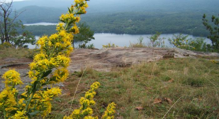
A hiking trail maintained by the Squam Lakes Association runs over this property, offering nice views of Squam Lake.