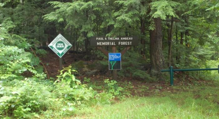

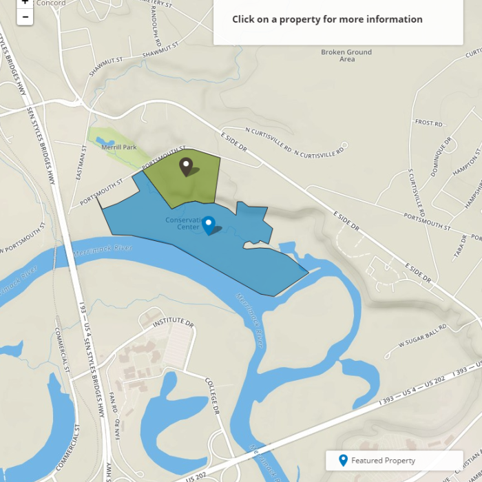
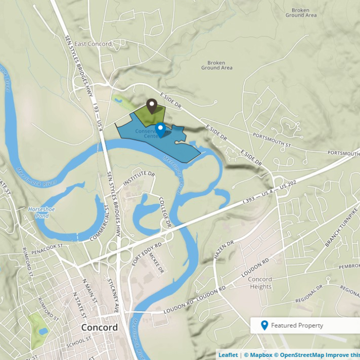
About the Property
It’s often called just the floodplain, but its full name is the Merrimack River Outdoor Education and Conservation Area.
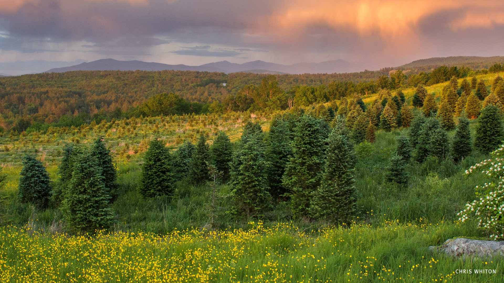
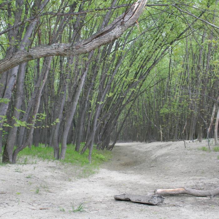
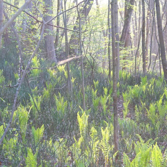
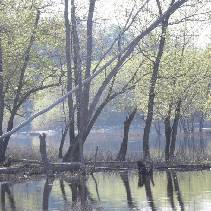
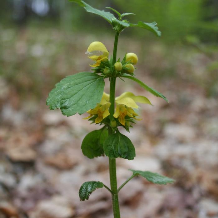
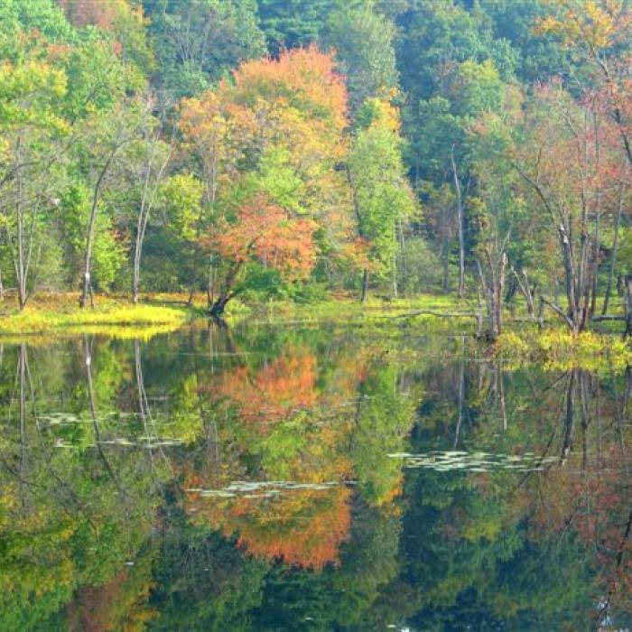
The dramatic floodplain landscape includes oxbows, back channels, and high terraces that host a dynamic collection of overlapping natural communities. A walk down the Les Clark Nature Trail will take you past a pine forest planted in the 1960s, a wooded swamp and beaver-influenced wetlands, a maple-oak-hickory terrace community, and a native silver maple floodplain forest. The silver maple forest is unusual in New Hampshire; it has specifically adapted to life among the shifting sand and silt that line the state’s largest rivers. No other tree species can survive in this challenging environment, so the silver maples end up winning by default.
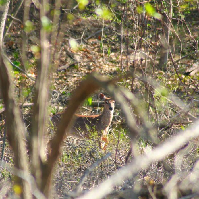
The floodplain offers a natural sanctuary for not only people, but for wildlife, including turtles, beaver, migratory waterfowl and other birds, such as the cardinal, oriole, bald eagle, osprey, pileated woodpecker, and rose-breasted grosbeak.
Try an Outing at this property

MROECA Outing: Eighteen points along the trail interpret features of interest as you hike the 1.5 mile loop.
Fishing Guide
With half a mile of frontage on the Merrimack River, the Merrimack River Outdoor Education and Conservation Area, near the Forest Society’s Conservation Center headquarters, has long been a destination for local anglers. The Merrimack hosts good populations of bass and other warm water species, and in some places (not here) hosts trout as well. From the parking area off Portsmouth Street, a pleasant walk along the trail leads to the river, but you’ll need to keep walking past the first sandy river bank you come to. This shoreline is steep and unstable. Don’t fish there, as it’s unsafe and it’s where bank swallows nest in the sandy cliffs. Bank swallows are uncommon in New Hampshire, and it’s best not to disturb them. Additionally, the sandy bottom along that section of the property isn’t good fish habitat. Keep walking along the riverbank to where the river splits into a side channel. This is a more productive area for fishing, as are the backwaters and side channels on the forested loop trail back to the parking area. While you’re there, notice the silver maple floodplain forest habitat and the many bird species that call this special place home.
Thank You
Annual sponsorship of the Merrimack River Outdoor Education and Conservation Area generously provided by Merrimack County Savings Bank and Northeast Delta Dental.


Trail Information
Les Clark Nature Trail
Yellow Rectangles
Over 2 miles of walking trails through pine plantation, floodplain forest, and along the Merrimack River.
·Open from dawn to dusk. Parking lot gate is locked at the hours listed at the entrance of the lower parking lot. Towing is enforced.
·All pet waste must be carried out, and owners must maintain active and vocal control over pets at all times.
·Enter the river at your own risk.
·Keep people and pets off river banks to avoid increased erosion and disturbance of wildlife, such as turtles and bank swallows.
Leaving from the parking area, this loop trail meanders through a restored wetland that is adjacent to Mill Brook, a tributary of the Merrimack River. Devastating floods in the spring of 2006 closed this area to recreation, and the wetland is being given a chance to revert back to the vibrant natural community it once was. At about 0.2 miles, the trail passes through a red pine plantation that was planted in the late 1960s. Beyond the plantation, the trail opens out to the open banks of the Merrimack River. There is an information kiosk in this location.
From the kiosk, go left (east) along the bank of the Merrimack River. The meadow you see to your left, dominated by a grass called little bluestem, is kept open by mowing every six years or so. In the summer, bank swallows nest in burrows in the exposed sand cliffs on the edge of the river. You may enjoy watching them swoop in and out of their nests, but please do not climb down the banks in this area (or let your dog do so) as this will disturb their nesting.
The trail eventually leads into the woods to a silver maple floodplain forest along the river’s edge. This unique natural community provides habitat for a variety of unusual plants, migratory birds, and other wildlife. About 0.2 miles after entering the silver maple floodplain forest, you will pass Eastman Cove on your right. This area is an oxbow marsh, a former meander of the Merrimack River that has been cut off as the river changed course. From Eastman Cove the trail wanders through floodplain forest paralleling Mill Brook for approximately 0.5 miles before reuniting with the original trail near the pine plantation. Take a right here and retrace your steps 0.15 miles back to the parking area.